In 2016, the Colombian government signed a peace agreement with the Revolutionary Armed Forces of Colombia, (FARC-EP), the oldest guerrilla group in Latin America. This agreement was a big step towards the end of an internal war of more than fifty years that has left 9,708,038 identified victims, 83 percent of which suffered forced displacement according to the Unique Registry of Victims (RUV). According to official data, 93 per cent of the people displaced since the 1990s relocated in urban areas. Although the Colombian armed conflict has traditionally been considered a rural phenomenon, cities have witnessed a massive influx of internally displaced population. According to the Global Report on Internal Displacement, at the end of 2016 Colombia had the highest number of internally displaced people (IDPs) in the world, surpassing Afghanistan, Nigeria and South Sudan together as well as Syria, the second largest country with IDP’s, by a wide margin.
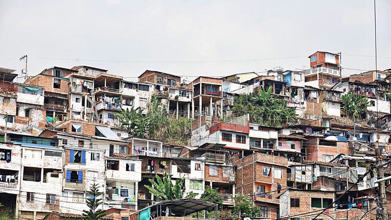
Our research project analyzes urban resilience and reconstruction at the margins of medium-sized cities over half of a century of armed conflict in Colombia. Mapping Urban Change in Colombia focuses on the period ranging from the beginning of the 1970s, when the FARC-EP began its territorial expansion towards the center and eastern areas of the country, to 2017, when the disarmament process began after the signing of the peace agreement. In this project we examine some of the macro and micro effects of this urban transformation over time. For the former, we study how the state has responded to the massive displacement of people to cities through housing, employment, food security, and environmental policies, as well as basic services provision. We also analyze how victims faced a new life in the margins of medium-sized cities and how they managed to recover from the devastating effects of war. To do so we focus on measuring the growth of informal housing by municipality including urban expansion and densification (Stanford team focus using RS data, GSV imagery, and GHSBUILT dataset) and, to see the micro effects, we focus on case studies based on archival material and testimonies from victims, collected by the National Center for Historical Memory. These testimonies will allow us to see first-hand how victims deal with daily problems of work, education, health and food and adapted to their new circumstances (Universidad de los Andes team focus). A combination of data on urban built environments and socio-economic indicators coming from aggregated data and case studies, will reveal the ways in which the state and the displaced people have responded, adapted and even improved urban essential functions when faced to pervasive violence and displacement (Bahadur et al., 2015, Arup International Dev., 2015; IPCC, 2014; IOM, 2016).
Contributing Research Assistants:
Alexander Mackworth Mendoza, Stanford University
Nicolás Cabra Ruiz, Universidad de los Andes


Mail: Bldg 160, Rm 228 - In Person: Fourth Floor
Stanford, CA 94305-2055