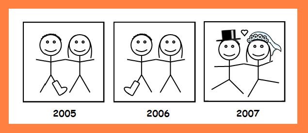
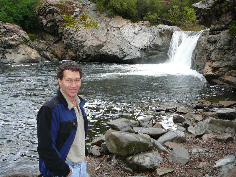
Jen and Tor's Wedding
Please join us Saturday, July 28th, 2007
to celebrate the (hopefully) ambulatory wedding of
Jennifer Chiau-Ching Wu
and
Tor Otto-Careful Raubenheimer
Outdoor ceremony 4:00 pm
Dinner reception and dancing at
The Evergreen Lodge
at Yosemite
Participants:
The wedding and reception will take place at the Evergreen Lodge. A number of cabins are on hold – for more information contact the lodge at: http://www.evergreenlodge.com/ or (800) 93-LODGE.
There are a number of other options available off of highway 120 which are about 30 minutes away. These include: Sunset Inn (209) 962-4360; Yosemite Riverside Inn (209) 962-7408; Buck Meadows Lodge (209) 962-6366; and the Yosemite Westgate Lodge (209) 962-5281. Additional lodging can be found in the town of Groveland which is about 45 minutes away. There is a table of lodging from Yahoo with links below.
|
Evergreen Lodge-Yosemite |
33160 Evergreen Rd |
0.0 |
|
Sunset Inn |
33569 Hardin Flat Rd |
5.2 |
|
Yosemite Riverside Inn |
11399 Cherry Lake Rd |
6.2 |
|
Buck Meadows Lodge |
7647 State Highway
120 |
7.5 |
|
Yosemite Westgate Motel |
7633 State Highway
120 |
7.5 |
|
Groveland Motel |
18933 Main St Hwy
120 |
14.3 |
|
Brooks Berry Inn |
7567 Hamilton Station Loop |
12.8 |
|
Yosemite Rose Bed & Breakfast |
22830
Ferretti Rd |
16.1 |
Camping:
There is fancy camping at the Evergreen lodge for roughly $50/night. In addition, there is the US Forest Service Dimond O campground a few miles away on Evergreen Rd. Other camping sites include Hodgdon Meadows just inside Yosemite Park and the USFS Lost Claim and Sweetwater campgrounds off of highway 120. Reservations for Hodgdon Meadows and the Dimond O campgrounds can be made on the park service website http://www.recreation.gov/ while sites at the Lost Claim and Sweetwater are 1st come 1st serve.
Pets:
Don't know the policy at the Evergreen Lodge but we'll check. Yosemite National Park has a policy forbidding dogs on trails and off leash although we know of people who have ignored these postings at times – be careful as the fines are large.
The Evergreen lodge is at 4,500 feet. The weather in July/August usually has days in the high 80's to mid 90's with evenings in the 60's. This is similar to Yosemite Valley and warmer than in Tuolumne Meadows which is up around 8,600 feet. Rain is unlikely although afternoon thunder showers do sometimes arise.
Bay Area airports – San Francisco (SFO), San Jose (SJC) and Oakland (OAK) – are probably your best if you’re flying in. Drive time from all three airports is about four hours, though depending on traffic conditions and the driver, you could make it to Evergreen Lodge in about three. Tor’s record from Palo Alto to the entrance of the Park is 2.5 hours.
If you’re coming from Seattle or Salt Lake City, direct flights are available to Fresno-Yosemite International (FAT), which will cut your drive time down to about three hours -- rental cars may be cheaper as well.
For more airport options, please see: http://www.nps.gov/yose/planyourvisit/airports.htm
Driving Directions
Take CA-120 East toward the Big Oak Flat Entrance to Yosemite National Park. Twenty-two miles past Groveland (a half mile before the entrance to the Park), take a left on Evergreen Road. Evergreen Lodge is seven miles down the road on the left.
For detailed driving directions from various California locations and airports, see http://www.evergreenlodge.com/directions.html.
The area around the Hetch-Hetchy has many possibilities. There is climbing, hiking and biking, fishing, touring, whitewater rafting and swimming. There are a number of great swimming holes along the South and Middle forks of the Tuolumne river which can be accessed by driving, biking, or hiking. We will list what we know of people's schedules and activity desires to help coordinate.
The Evergreen Lodge is ~15 miles from the Hetch Hetchy reservoir in Yosemite National Park and there are a number of hikes from the access road – the O'Shaughnessy Dam is pretty cool to check out as well and there is a neat tunnel through the cliff wall on the far side of the dam. Yosemite Valley and Tuolumne Meadows are short drives (~1hr) away.
An adjacent camp, Camp Mather, has a pond and other play facilities which can be used by day visitors. The Evergreen has some rental bikes http://www.evergreenlodge.com/rentals.html and better bikes can be rented in Sonora or Groveland.
We (Jen, Cade, and Tor) will be at the Evergreen Thursday afternoon through Sunday and possibly Monday. We will try to organize some group trips for those who are interested – check the web site for more information. We can also try to arrange childcare for those who may be interested – let us know.
There is some great (although hot) climbing in the Hetch Hetchy area. We will post topos and links when we find them. Of course, there are also the Meadows and Valley.
There are many great hikes in Yosemite National Park. In late July, it will be hot down by the Hetch Hetchy reservoir but Tuolumne Meadows will be beautiful. The trail map for Yosemite is linked. Some suggested hikes in the Hetch Hetchy area follow:
Wapama Falls and Rancheria Falls:
The 5.4-mile roundtrip hike to Wapama Falls is suitable
for all ages and abilities. It makes gradual climbs and descents
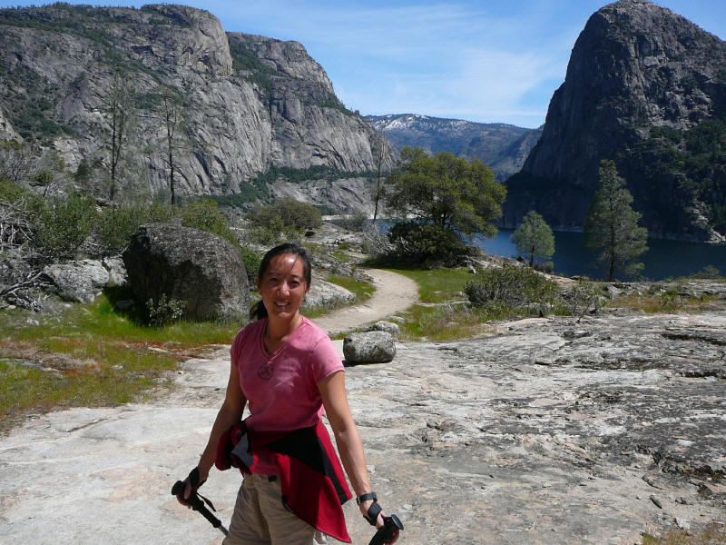 along the
reservoir as it winds its way to Wapama Falls. The Lake Vernon trail junction is
located one mile from the trailhead. Those wishing for more of a workout can
turn left and begin a serious climb to the granite slabs above and a view of the
reservoir and the high country peaks. To continue to Wapama Falls, continue
straight, passing the seasonal Tueeulala Falls after 1.5 miles. The
Wapama Falls are another mile.
along the
reservoir as it winds its way to Wapama Falls. The Lake Vernon trail junction is
located one mile from the trailhead. Those wishing for more of a workout can
turn left and begin a serious climb to the granite slabs above and a view of the
reservoir and the high country peaks. To continue to Wapama Falls, continue
straight, passing the seasonal Tueeulala Falls after 1.5 miles. The
Wapama Falls are another mile.
Rancheria Falls is another 4 miles from Wapama
Falls. This can be done as either a out-and-back (roughly 13 miles) or as
a roundtrip returning via Lake Vernon (about 20 miles). Heading to
Rancheria Falls, the trail climbs and then levels about 1.5 miles past Wapama
Falls. It then crosses a footbridge over a creek at five miles out from
the trailhead,
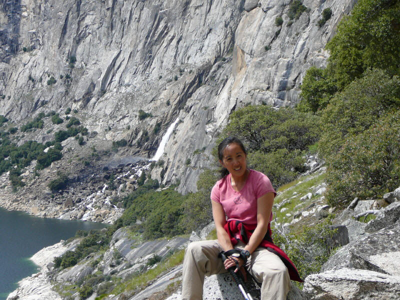 then
climbs past some inviting swimming holes and water slides located along the
creek. At the six-mile mark, reach a junction with a connector trail that leads
to a Ponderosa pine and incense cedar-shaded campsite located below Rancheria
Falls. Stick with the main trail for another half mile to reach a
bridge over Rancheria Creek that's located just above the falls. From here one
can make a long journey back (about 12 miles) by heading north or simply retrace
your steps back to the trail head.
then
climbs past some inviting swimming holes and water slides located along the
creek. At the six-mile mark, reach a junction with a connector trail that leads
to a Ponderosa pine and incense cedar-shaded campsite located below Rancheria
Falls. Stick with the main trail for another half mile to reach a
bridge over Rancheria Creek that's located just above the falls. From here one
can make a long journey back (about 12 miles) by heading north or simply retrace
your steps back to the trail head.
To get to the trailhead, turn left onto Evergreen Road from the lodge, then take a right at the stop sign at Camp Mather. Continue through the entrance station and drive 8 miles to the O’Shaughnessy Dam. Park and cross the dam. The trailhead is on the far side of the dam and takes you through the tunnel in the mountain.
Preston Falls and Granite Pools:
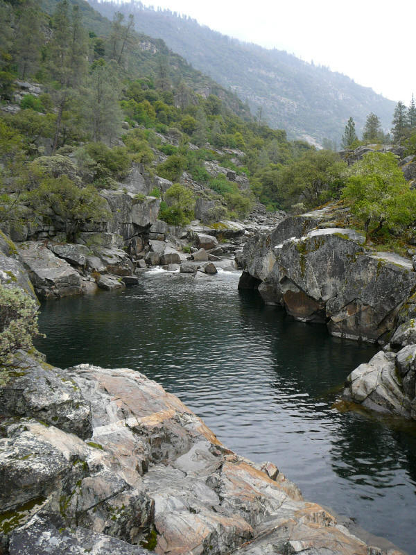
The Preston Falls trail follows the Tuolumne River upstream on the 4-mile journey to Preston Falls. Those wanting a shorter hike can stop at numerous spots along the river to relax and swim. This is an exposed trail, which can get very hot in the summer, drinking plenty of water will prevent dehydration. Granite Pools is a great swimming hole which is about halfway to Preston Falls - photo attached.
To get to the trailhead, take Evergreen Road to the Stop sign at Camp Mather and turn left (west) on Mather Rd. Follow this to the Cherry Creek Road. Make a right on Cherry Creek (towards Cherry Lake). The road descends steeply to the river. Take a right after the bridge (head upriver) and drive past the pumping station to the end of the road.
This is a very challenging hike. The Poopenaut Trail descends 1,200 feet in one mile! This just might be the steepest trail in the Sierra and for what its worth, one of the toughest to maintain due to severe erosion and steep dirt sections. This trail leads to the serene Poopenaut Valley and its lush meadows and sandy beaches along the river.
Once the valley floor is reached, head downstream about 500 yards to granite slabs and deep pools or explore the mellow stretches of river found in the meadows. Those seeking a great beach can cross the river and head upstream about 500 yards.
To get to the trailhead go to the Hetch Hetchy entrance gate and continue towards the Reservoir for about four miles. The hiker sign for Poopenaut Valley signifies the trail and the parking area. Parking is on the right side of the road, cross to the other side to start the descent. Give yourself plenty of time to climb out of Poopenaut Valley and remember the entrance gate closes in the evening.
Still in the works.
There are a number of swimming holes that may be attractive:
 The Rainbow Pools are just south of
highway 120 opposite the Cherry Lake road turn-off. This is about 10 miles
west of the Evergreen road and at the bridge crossing the South fork of the
Tuolumne river. The best approach is to take the road on the west side of
the bridge. There will be parking in a short distance. You can also
bike to the Rainbow pools from the Evergreen Lodge. Go up to Mather Rd by
the Mather Camp and head left (west). Follow this to Cherry Lake road and
take that south. It will intersect highway 120 and the pools are just on
the other side - this is about 14 miles DOWNHILL riding on back roads but the
roads are all paved and are in great condition. The Lodge can arrange to
pick you up if the return trip does not appeal!
The Rainbow Pools are just south of
highway 120 opposite the Cherry Lake road turn-off. This is about 10 miles
west of the Evergreen road and at the bridge crossing the South fork of the
Tuolumne river. The best approach is to take the road on the west side of
the bridge. There will be parking in a short distance. You can also
bike to the Rainbow pools from the Evergreen Lodge. Go up to Mather Rd by
the Mather Camp and head left (west). Follow this to Cherry Lake road and
take that south. It will intersect highway 120 and the pools are just on
the other side - this is about 14 miles DOWNHILL riding on back roads but the
roads are all paved and are in great condition. The Lodge can arrange to
pick you up if the return trip does not appeal!
 Granite Pools
are located about 2 miles from the start of the Preston Falls trailhead.
One can either drive or ride to the trailhead.
Take Evergreen
Road to the Stop sign at Camp Mather and turn left
(west) on Mather Rd. Follow this to the Cherry Creek Road.
Make a right on Cherry Creek (towards Cherry Lake). The road descends
steeply to the river. Take a right
after the bridge (head upriver) and drive past the pumping station to the end of the road.
The Lodge can arrange to pick you up if you
don't want to ride back.
Granite Pools
are located about 2 miles from the start of the Preston Falls trailhead.
One can either drive or ride to the trailhead.
Take Evergreen
Road to the Stop sign at Camp Mather and turn left
(west) on Mather Rd. Follow this to the Cherry Creek Road.
Make a right on Cherry Creek (towards Cherry Lake). The road descends
steeply to the river. Take a right
after the bridge (head upriver) and drive past the pumping station to the end of the road.
The Lodge can arrange to pick you up if you
don't want to ride back.
There are a number of pools that can be accessed by hiking down to the river. One of the best (although hottest) is the Poopenaut Valley trail (the Preston Falls trail provides easier access to the river) -- see Hiking.
Three other great swimming holes are Lake Tenya in Tuolumne Meadows, the Merced River in Yosemite Valley, and Devil's Bathtubs under the Royal Arches route in the valley. Lake Tenya has a large beach at the east end that is easily accessed from the parking lot just east of the lake -- there are picnic tables there as well. During the day it can be crowded but, in the evening, nobody is around and clothing is optional. There is a great swimming hole in the Merced right next to the Ahwahnee Hotel. From the hotel, walk across the lawn towards the river -- just before the bridge there is a deep hole although it is easiest to get in from the gravel bar on the other side of the river. The Devil's Bathtubs are above the Ahwahnee hotel -- head up to Peruvian Flake and scramble up the gulley to the left of the climb. Continue along the gulley to a flat section with a few large trees -- water coming down from the top of Royal Arches warms up on the rock and fills a few bathtubs - one is ~6 feet deep - clothing optional.