Imago Urbis: Giuseppe Vasi's Grand Tour of Rome
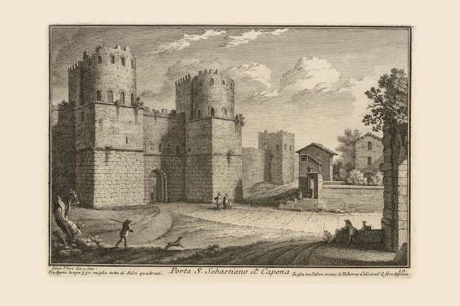
The ancient name of Porta S. Sebastiano was Porta Appia (not Capena, which was a gate in the Republican walls), after the ancient Via Appia which led south and east all the way to Brindisi. The later name refers to S. Sebastiano fuori le Mura (St. Sebastian outside the Walls), the church being located two miles further out on this road. Originally the gate had two entrance arches, but these were reduced to a single arch at the time of Emperor Honorius (395-423 AD), who also had the massive circular towers encased with the square bases visible now. The Nolli map shows a perimeter road along the walls and the two farm buildings depicted by Vasi at the right, but not the open gate at the extreme right edge of the print.
|