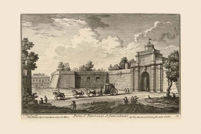
Porta S. Pancrazio marks the high point of the Janiculum hill, over which the ancient Via Aurelia approached the city. It was chosen as the site for the ancient Porta Aurelia in the 3rd century imperial walls. When Urban VIII (1623-44) built the new walls around Trastevere (also linking with the Renaissance Borgo walls) this gate was rebuilt, thus becoming a common element to both sets of city walls, as can be seen on the Nolli map. The name of the gate derives from the church of S. Pancrazio which Nolli shows curiously enveloped by the scrolled edge of his map. In 1849 it was seriously damaged by French cannon fire during the siege of the city. It was rebuilt by Virginio Vespignani in 1854 under Pius IX (1846-78) upon his return to Rome from exile. Vasi's print depicts the Urban VIII gate, with one of the ponderous pentagonal bastions of the Baroque wall beyond it. The Nolli map reveals the distant building at far left to be the casino of the ex-urban Vigna Sabbatucci. The travelers in the right foreground are approaching the gate from the Via Vitellia which Vasi notes extends south to the sea.
|